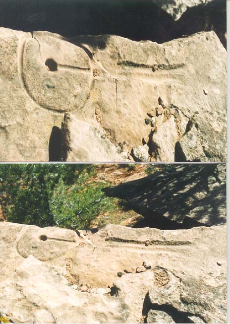
David Maxwell, Director of Southern Utah University's GIS/GPS Lab, offered this insight regarding the glyphs within hours of spending his first day with the team.
Viewing the glyphs as a professional map maker, Dave pointed out that in order for these glyphs to function as navigational markers, they would have to function in both directions "going" or "returning" from a location. Having seen less than 7 glyphs, Dave hit upon something other team members had already witnessed... but not understood.
If Dave's theory was correct, then the straight line would have to represent the topography in both directions.
In other words, the glyph would have to be created and positioned in exactly the right location so that it could be read by travelers headed in either direction "moving" it even a few inches would destroy it's integrety.
Other team members had already found examples of this fact. In patricular, where a glyph had fallen, and where it would have clearly been much easier to simply move the mark a few feet, the origional creator of the glyph had taken great pains to have the glyph "line up" with something and had literally "wraped" the circle portion of the glyph around the rock.
Dave also speculated that the circle would most likely represent the user's field of view from that point (what we would today call horizon") and that the dot(s) might indicate the position/distance to an object in relation to the visible horizon.
Oddly enough, this theory was later co-oborated by the Paleo-Hebraic theory.
| TEAM MEMBERS | WORKS CITED
CONTACT US @ WATER GLYPHS